
Wednesday, 30 April 2008
Tuesday, 29 April 2008
Day 35
The Met office provides weather information for many different purposes. If you go to the aviation section of their website (http://www.metoffice.gov.uk/aviation/index.html) you will find a wealth of actual and forecast weather information pertinent to pilots.
A METAR is a Meteorological actual report, and shows the observed weather conditions at an airfield, including visibility, wind speed and direction, cloud and precipitation.
A TAF is a terminal area forecast, and provides an indication of the forecast weather conditions over the next few hours.
From these and the synoptic charts it is possible to build up a good picture of the likely conditions prevailing during a planned flight. The minimum weather conditions required in order to fly mainly depend on the pilots qualifications and the aircraft.
Why am I telling you all this? Today was another no-flying day. The visibility was around 5km, which is just legal but does not provide a good view for visual navigation. The cloudbase was more of a concern at around 1500ft it meant that there was marginal clearance over some of the higher land and obstacles around. The real problem is when the terrain rises to meet the cloud (or vice versa). Many pilots have found to their cost that 'scud running' as its called under clouds is a practice best avoided.
So I'll look at the TAFs and METARs for tomorrow....
Monday, 28 April 2008
Day 34
My instructor wanted me to demonstrate a full test profile today, which we did via Branscombe and Dunkeswell. My skills continue to slowly improve, and I have been cleared to take the pre-test "170A" flight tomorrow. If that all goes well then I could be taking the CPL skills test on Wednesday.
No pressure.
No pressure.
Friday, 25 April 2008
Day 33
Hooray. The weather was (just) good enough for my nemesis flight to Bembridge today. After departing from Bournemouth we encountered a layer of cloud below us at about 1200ft. I am not rated to fly when not in sight of the surface (yet) and so we used my instructor's privileges to remain legal until we saw a gap in the clouds as we approached Bembridge.
I am pleased to report that the circuits were successful. Didn't crash or trundle off the end of the runway.
We then departed low-level towards Romsey via Lyndhurst at just about our minimum altitude to avoid the low cloud.
So an unusual flight, but I feel that the Bembridge curse has been broken.
I am pleased to report that the circuits were successful. Didn't crash or trundle off the end of the runway.
We then departed low-level towards Romsey via Lyndhurst at just about our minimum altitude to avoid the low cloud.
So an unusual flight, but I feel that the Bembridge curse has been broken.
Thursday, 24 April 2008
Day 32
Unbelievable. That same aircraft, straight from its repair after the hydraulic leak, had an engine problem (difficulty starting and severe vibration) fortunately before take-off, with another student.
Coupled with that, reports of 'windshear' at Bembridge meant that today was another no-flying day.
I hope and pray that tomorrow everything will line up well: the weather, the aircraft and the student. Will keep you posted (or is it blogged?).
Coupled with that, reports of 'windshear' at Bembridge meant that today was another no-flying day.
I hope and pray that tomorrow everything will line up well: the weather, the aircraft and the student. Will keep you posted (or is it blogged?).
Wednesday, 23 April 2008
Day 31
You remember the old adage "If it ain't broke, don't fix it". I am personally not a great fan of this 'wisdom' as in my experience it is used as an excuse to not seek improvement in a task, process or product. In my former life as a Patent Attorney, and in my former company which virtually invented the concept of 'continuous improvement' within the electronics industry, the rule was "if it ain't broke, break it".
However, I have since learned one important proviso to that, which is that for some strange reason, most aircraft technical faults seem to occur just after a spell in the hangar for maintenance.
A frustrating day today. I was due to fly an aircraft freshly returned from its CAA Annual inspection. Another student was to fly the aircraft before me, and upon his preflight inspection he saw hydraulic fluid leaking out of the fuselage.
By the time another aircraft was available we had basically run out of time, so we'll try again tomorrow.
Tuesday, 22 April 2008
Day 30
Much haze today, some of which was obviously between my ears, as my 'routine' profile to Bembridge on the Isle of Wight turned into a catastrophe. The visibility was down stated as being 6km, although looking into the sun it was more like 1.5km.
Without dwelling too much on the details, I received a routing from Bournemouth which didn't fit my planned track, so I had to improvise the navigation to the Island. Fortunately it is quite hard to miss, so no great panic there.
However arriving into Bembridge was not my best effort, partly because I've been there so many times in the Cessna 150. Keeping a tight circuit is easy at around 80 kts with one engine, but in the Duchess, a little more planning and distance are required. Needless to say the first circuit was rushed and I was too fast, too high and too close to the runway without being ready.
So we 'went around' (aborted the landing) and tried again. The second and third circuits were better, but the overall flight was not satisfactory and so I will need to do it again tomorrow. Same sortie, hopefully better weather and hopefully a more alert and concentrating pilot.
Monday, 21 April 2008
Friday, 18 April 2008
Day 28
A no-flying day today. The weather was technically 'orrible and the air was described by one instructor as 'lumpy'.
Thursday, 17 April 2008
Day 27
And another shorter profile today. Longleat House, Salisbury racecourse, a couple of steep turns and....
an engine shutdown.
Most of the emergency drills that we practice are simulated, in that the instructor simply pulls back the throttle on one engine and then declares 'you have an engine failure', or he puts a cover over several instruments and declares 'you have a systems failure'. This is of course preferable to a) a real emergency or b) turning off a critical system, with the risk that it may not be successfully restarted.
In a single engined aircraft most pilots (except perhaps the one on the right) wouldn't dream of deliberately stopping the engine and then trying to restart it in flight. However in a multi-engined aircraft the risk of endangering the flight is much less, since there is one further engine perfectly capable of getting you home. Fully shutting down an engine and restarting it again must be performed for the examiner during the skills test, and so obviously we have to practice it once or twice beforehand.
So that's what we did. And it restarted again. Which was nice.
an engine shutdown.
Most of the emergency drills that we practice are simulated, in that the instructor simply pulls back the throttle on one engine and then declares 'you have an engine failure', or he puts a cover over several instruments and declares 'you have a systems failure'. This is of course preferable to a) a real emergency or b) turning off a critical system, with the risk that it may not be successfully restarted.

In a single engined aircraft most pilots (except perhaps the one on the right) wouldn't dream of deliberately stopping the engine and then trying to restart it in flight. However in a multi-engined aircraft the risk of endangering the flight is much less, since there is one further engine perfectly capable of getting you home. Fully shutting down an engine and restarting it again must be performed for the examiner during the skills test, and so obviously we have to practice it once or twice beforehand.
So that's what we did. And it restarted again. Which was nice.
Wednesday, 16 April 2008
Day 26
Another test profile today, this time from Bournemouth to Illminster, then reposition at Dunkeswell for a few circuits, before returning to Bournemouth using the IFR screens.
I'm finding that putting all of the separate training elements together is quite a challenge. Although I have no direct experience of playing golf, I imagine it may be similar in terms of a golfer's game comprising stance, grip, aim, swing, follow-through and so forth. Concentrating too much on any one element runs the risk of diminishing performance in the other elements. Until of course, they become second nature.
Basically I can fly the aircraft without too much difficulty. I can also navigate my way around. I can communicate via the Radio. I can fly on instruments. I can perform the 'set-piece' maneuvers required for the skills test, and I can fly circuits. But putting them all together at the same time and concentrating very hard for two hours has not yet become second nature.

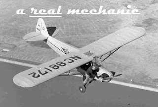
For those who enjoyed last week's humorous photo, here is another, taken from the 'take your kids to work' day archives:
I'm finding that putting all of the separate training elements together is quite a challenge. Although I have no direct experience of playing golf, I imagine it may be similar in terms of a golfer's game comprising stance, grip, aim, swing, follow-through and so forth. Concentrating too much on any one element runs the risk of diminishing performance in the other elements. Until of course, they become second nature.
Basically I can fly the aircraft without too much difficulty. I can also navigate my way around. I can communicate via the Radio. I can fly on instruments. I can perform the 'set-piece' maneuvers required for the skills test, and I can fly circuits. But putting them all together at the same time and concentrating very hard for two hours has not yet become second nature.

For those who enjoyed last week's humorous photo, here is another, taken from the 'take your kids to work' day archives:
Tuesday, 15 April 2008
Day 25
A 2 hour test profile today. A northerly departure from Bournemouth, to Kingsclere via Andover. Then on to Blackbushe, Basingstoke, Portsmouth and back to Bournemouth. Anybody look up at around 12.00 when I flew over Festival Place?
Having been to Kingsclere many times, it being on the main road from Basingstoke to Newbury, you might think that it would be easy to identify. However from the air a different set of features need to be used to positively identify a town or village. With the aid of a CAA 1;500,000 map, the following basic methods can be used:
Firstly there is the shape. Petersfield, for example, looks like a kidney.
Secondly, roads, rivers and railways may provide unique clues. e.g. Hungerford is the only town west of Reading where a river and a canal meet, alongside a railway line (and the railway crosses the river one mile further west).

 Finally, certain other features such as racecourses, chalk carvings (left) and towers like the Hannington mast (right) might just remove any doubt. Kingsclere is about a mile north of the Hannington mast, which extends to 1200ft above sea level (500 ft above the ground), so its a dead giveaway. Of course you have to be above 1200ft on the QNH (sea level altimeter pressure setting) when you pass over it, otherwise its a dead pilot.
I tried to persuade my instructor that I was unfamiliar with the area, so that he would think I was finding my way properly, but when we passed overhead Basingstoke I made the mistake of pointed to my house, and the game was up. We then headed south over the Spinnaker tower at Portsmouth, and over to the Isle of Wight before returning to Bournemouth.
Having been to Kingsclere many times, it being on the main road from Basingstoke to Newbury, you might think that it would be easy to identify. However from the air a different set of features need to be used to positively identify a town or village. With the aid of a CAA 1;500,000 map, the following basic methods can be used:
Firstly there is the shape. Petersfield, for example, looks like a kidney.
Secondly, roads, rivers and railways may provide unique clues. e.g. Hungerford is the only town west of Reading where a river and a canal meet, alongside a railway line (and the railway crosses the river one mile further west).
 Finally, certain other features such as racecourses, chalk carvings (left) and towers like the Hannington mast (right) might just remove any doubt. Kingsclere is about a mile north of the Hannington mast, which extends to 1200ft above sea level (500 ft above the ground), so its a dead giveaway. Of course you have to be above 1200ft on the QNH (sea level altimeter pressure setting) when you pass over it, otherwise its a dead pilot.
I tried to persuade my instructor that I was unfamiliar with the area, so that he would think I was finding my way properly, but when we passed overhead Basingstoke I made the mistake of pointed to my house, and the game was up. We then headed south over the Spinnaker tower at Portsmouth, and over to the Isle of Wight before returning to Bournemouth.
Monday, 14 April 2008
Day 24
Last day in the sim today, at least until after the CPL. I'm now finding that most of the procedures and maneuvers are now fairly straightforward if the 'wind' is generated by a computer and the air is completely smooth (because we are flying along at an altitude of about 3 feet, in a small room).
So the sim has served its purpose. Like many professions and walks of life, an artificial environment is useful up to a point, but there's nothing quite like the real thing (ask my wife, who is a midwife, whether stitching a chicken leg is the same as suturing a woman who has just given birth!)
So now its time to put everything together in some 'test profiles', i.e. mock exam flights. I hope you're not still thinking about the chicken.
Friday, 11 April 2008
Day 23
The end of my fifth week in Bournemouth, and just an hour in the sim today to practice position fixing. Next week could conclude my CPL training, although it is unlikely that there will also be time for the skills test next week.
This test is a 2 hour flight with an examiner, in which all the main elements of the syllabus are covered. Flight planning, departure procedures, navigation (including a diversion), instrument flying, general handing, arrival procedures, circuits, emergency procedures (including engine failures) and radio navaid procedures. Probably the toughest two hours of my life so far. Can't wait.

This test is a 2 hour flight with an examiner, in which all the main elements of the syllabus are covered. Flight planning, departure procedures, navigation (including a diversion), instrument flying, general handing, arrival procedures, circuits, emergency procedures (including engine failures) and radio navaid procedures. Probably the toughest two hours of my life so far. Can't wait.

Thursday, 10 April 2008
Day 22
Airmanship.
Most of us know that there is a difference between being passing your driving test and being a good driver. The test sets a minimum standard, but developing 'road sense' probably comes later.
The flying equivalent of 'road sense' is called 'airmanship' (sorry, this term is used for women pilots too!) and encompasses the overall ability of a pilot to be in control of the aircraft, to have good situational awareness and perhaps most importantly, to be able to prioritise tasks appropriately. Now that most of the syllabus has been completed, my flight today and and most of the remaining sorties before the test will be concerned with putting all of the elements of the course together, and combining these with good airmanship.
One of the phrases that my former colleages in AIMAIR referred to often was 'AVIATE, NAVIGATE, COMMUNICATE'. This is a useful way to remember a fundamental priority order for this fascinating business of flying.
AVIATE: keep flying the aircraft. Whatever else happens, it is vital to remain in control of the aircraft at all times. Sounds obvious, but it is surprising how many accidents have occurred because a pilot spent too long looking at the map on his/her lap, and flew into the ground or another aircraft. Even in a crash situation, the pilot's duty is to maintain control of the aircraft. It is far better to 'land' on a tree in a controlled manner than to merely crash into one (after all anyone could do that).
NAVIGATE: The second priority after flying the aircraft is to fly it in a particular direction. Again this sounds obvious, but it may surprise you to learn just how many aircraft infringe controlled or restricted airspace because the pilot was lost or 'temporarily unsure of position'.
In 2007 there were more than 600 occurrences of airspace infringements in the UK (see http://www.flyontrack.co.uk/infstats.asp) So a pilot should always have a navigational plan, should be generally aware of the airspace around them, and should prudently use radio navigation aids.
COMMUNICATE: Finally, the pilot should maintain an appropriate level of communication with Air Traffic units on the ground, and possibly other aircraft. Some pilots fly around and never talk to the radar controllers and airfield radio operators who are there to help them. Others spend too much time talking to them and not enough time AVIATING and NAVIGATING. It is important to think about who to talk to and what to say, as inefficient use of the radio wastes time and can distract pilots and controllers from potential problems. It's good to talk, as the BT advert says, but communicating is less critical than continuing to fly the aircraft or knowing where you are going.
There is much more to airmanship than just these three, but I think they are a good place to start.
Wednesday, 9 April 2008
Day 21
All of a sudden, I've done 18 hours of flying, and with only 10 more to go (of which 2 are in the sim) the test is looming. Today's flight included a little more nav and some more instrument flying, this time with the added bonus of a land-away at Dunkeswell airfield (a few miles north-east from Exeter) and my first 'unusual attitude' recovery under partial panel instruments (see day 16).
This involves giving the controls to the instructor, and allowing him to have 30 seconds of fun zooming around and turning the aircraft on its side, before putting it in an unusual attitude such as a spiral dive or a steep turning climb.
Then with reference only to instruments the student has to recover control of the aircraft, returning it to straight and level flight at normal airspeed. This exercise used to be done for the Private Pilots license, but with reference to the outside horizon AND all the flight instruments.
 Its a bit more fun (which is code for a rather tricky) doing it on partial panel with no outside horizon.
By the way the Duchess has a set of 'screens' which can be erected in flight to simulate entering into cloud and losing the visual horizon. The picture on the left (not of me or any of my fellow students) shows you the screens, which are arranged in such a way that the instructor (right) still has a reasonably good lookout whilst the student's outside view is almost completely obscured.
Tuesday, 8 April 2008
Day 20
I've mentioned NOTAMs before back in day 10. Before every flight the NOTAMs must be checked along with the weather, because they can make a huge difference to the flight plan.
Today, my route was to get to Hungerford by any convenient route, and then turn west and fly overhead Devizes and then Paulton (south of Bath) before turning back towards Bournemouth.
Sounds easy, but there were several NOTAMs today that presented a real problem. Between Bournemouth and Hungerford is a Military Air Traffic Zone (MATZ) which contains Boscombe Down and Middle Wallop airfields. Plan A was to fly through the MATZ via Middle Wallop. However there is an active NOTAM this week indicating that their helicopter display team is practicing in the Middle Wallop Air Traffic Zone, so my plan could not take us into their immediate vicinity.
 Easy I thought, let's route via the Chilbolton radio telescope (left). Its easy to see from the air, is just on the edge of the MATZ, and it is far enough away from Middle Wallop to be a safe turning point en route to Hungerford. Nice, I thought.
However, another NOTAM then revealed that there is a tethered hot-air balloon being flown up to 5500ft from Chilbolton this month, and all aircraft are to remain clear by 1 mile in each direction.
So that put paid to plan 'B'. Routing further south or east was not an option as that would put me in Southampton's airspace, and routing further west would put me in the middle of the Salisbury plain military danger areas (get shot down, or get sent to jail, or both), where as it happened a Hercules was dropping parachutists. Best avoided then.
Since the weather was actually quite good today, with scattered clouds at 3500ft, I elected to make an early radio call to Boscombe Radar and then advise them that I would be climbing over the MATZ (which extends to 3000ft above ground level) in order to be above the helicopters.
So that's what we did; and it all went reasonably well. We didn't bust any airspace, get shot down or end up in court. Which was nice.
Monday, 7 April 2008
Day 19
 Through the snow to Bournemouth this morning. There were three accidents on the road as I drove down. One car was on its roof on the A303 just as it leaves the M3 at Basingstoke, and two more shunts further down the motorway. The weather is often a hazard on the roads, and it is even more so in the air.
Safely at Bournemouth I flight-planned for a trip to Evercreech, near Shepton Mallet in Somerset. The weather was potentially problematic, with a few thunderstorm (Cumolonimbus, or CB's, left) clouds and some rain around.
Pilots are particularly wary of CB's, since they are associated with severe turbulence and icing. The vertical air currents inside a CB cloud can be several thousand feet per minute.
Just for perspective, the Duchess climbs at around 1000ft per minute on two engines, and a comfortable descent would be a little less, at 500ft per minute (more than this and your ears can become uncomfortable as the pressure in the inner ear stabilises).
So flying into a CB could be quite an adventure, and assuming the wings are not ripped off due to the airframe stresses, they might come out the other side coated with a generous layer of ice, and so would lose most of their aerodynamic efficiency. Plus the effective aircraft weight would increase due to the weight of the ice, so all in all this is a situation better avoided.
With these happy thoughts in our minds, after lunch we set off and found that at 2500 ft we were able to remain clear of the clouds and steer around most of the rain. Once at Evercreech (15 minutes) I was then given a diversion to Charmouth near Lyme Regis, followed by another diversion to a town called Sturminster Newton, not far from Shaftesbury. The mental workload continues to increase, and I was on the radio to Compton Abbas airfield, Yeovil, Westlands, and Bournemouth Radar during the flight.
Friday, 4 April 2008
Day 18

 Radio Navigation. Now that we've completed the 'map and compass' navigation element, the next item to cover is radio nav, which means reviewing the avionics (aviation -electronics) systems required for navigation and communication.
This includes the VHF radio, VOR, DME, ILS and NDB radio beacon navigation systems, transponder and airborne GPS. The 'radio stack' which controls all of these is normally located in the centre of the instrument panel, between the two pilots' seats. In this way they can easily be reached by either pilot.
So this morning I spent two hours in the classroom with my instructor, revising how exactly we use these systems, followed by two hours in the simulator 'flying' around using the radio navaids to fix position and fly back to virtual Bournemouth.
I've now completed over 14 hours of flying (including the sim time) which means I'm over half-way through the CPL course. Scary.
Thursday, 3 April 2008
Day 17
Some more Nav today, this time mainly consolidation but slowly the workload is increasing. I am no longer getting any active assistance from my instructor, so whereas before he would set-up the next radio frequency and sometimes respond to ATC (air traffic control) for me if I were busy, now he leaves me to it, and if I miss something, he lets it play out until either I realise my mistake, or until it becomes necessary for him to intervene to ensure our safety!
 Today we flew up to the Sedgemoor services on the M5 (left). Believe it or not they are actually a VRP (visual reporting point) for Bristol airport, so air traffic reports at 'M5 Sedgemoor services' to enter or exit Bristol's airspace. Bournemouth to Bristol: 21 minutes!
This route also required us to get a clearance to transit through the Yeovilton Military Air Traffic Zone. Which was nice.
Wednesday, 2 April 2008
Day 16
Another good day for instrument flying in the simulator. The next item in the syllabus is 'partial panel' which means flying with some of the flight instruments not working.

For the CPL it is assumed that the instrument air/suction system has failed, knocking out both the Artificial Horizon and the Direction Indicator (the two instruments in the centre of the picture above). The AH gives the pilot pitch and bank attitude information (nose up/down, wings banked/level) and the DI gives heading information more accurately than is possible with a magnetic compass.
So without these two, instrument flying becomes much more tricky. The procedure is to use the remaining instruments to derive pitch attitude and heading information, which is not as easy as it sounds. You need to use the Turn Coordinator (bottom left) to assess bank angle of the wings and make heading changes, and you need to use the Altimeter (top right) along with some reference to airspeed (top left) to work out pitch information.
For example to turn left from 090 (east) to 315 (northwest), you need to use the Turn Coordinator, rolling the wings to the left until the wing lines up with the little mark just above the 'L'. You then start the stopwatch, and hold the wing on that mark. This gives you a 'rate 1' turn to the left, which is 3 degrees per second or 180 degrees in 1 minute. So by returning to 'wings level' after 45 seconds (135 degrees divided by 3 degrees per second gives 45 seconds), you should roll out on your intended heading. Then you wait for 10 seconds or so for the magnetic compass to stabilise and then have a look to see whether it worked.
Surprisingly (at least to me) it works brilliantly. I was able to roll out on heading, to within 5 degrees in most cases, just by using the Turn Coordinator and stopwatch.
Tuesday, 1 April 2008
Day 15
More NAV today, this time 'diversions'.
Yesterday's exercise was planned beforehand on a nice big desk, with a calculator, plotters, the map spread open and plenty of time to work out the calculations. Of course there was also the opportunity to make doubly sure that the lines drawn on the map were accurate, straight and correctly measured.
However, as you may have guessed, a diversion is by definition something other than a pre-planned route. What happens is that you are flying from A to B (in my case today from Wellington to Frome) with about 3 minutes to run when the instructor says "when you get to Frome, we will be diverting to Puddletown. Please continue to Frome and then set your new course, and when convenient please provide me with details of your planned heading, altitude and ETA for Puddletown"
Aargh! First thing, continue to fly the aircraft. Second get out the map and pen and plotter (how many hands have I got?), draw a line from Frome to Puddletown. Fly the aircraft. Keep a lookout. 2 mins 30 to Frome.
Then measure the track (in degrees from true north) of the line, and the distance in nm. Fly the aircraft. Keep a lookout. 2 mins left to Frome.
Then calculate (or guestimate) the wind component and magnetic variation, and add or subtract these from the track to come up with a planned heading. Fly the aircraft. Keep a lookout. 1 min 30 to Frome.
Use the wind component to estimate the groundspeed, and use that to calculate the enroute time for the diversion. Fly the aircraft. Keep a lookout. 1 minute to Frome.
Now we need to look for Frome, making sure we pass overhead already set up on our new heading. A quick glance at the map again to see whether once we have turned there are any hazards or obstacles to deal with, such as controlled airspace, airfields, danger areas etc...
...and guess what? We are at Frome, so we turn onto our new heading, reset the timer and make a radio call. We'd better hope that all those calculations were correct, because now we are relying on them to get us to Puddletown. Time now to do a systems check, all the time flying the aircraft and keeping a good lookout! Half way to Puddletown (in about 4 minutes) we'll try to estimate position and decide if we need to make any adjustments. For now, its time to relax, take a breather, all the time flying the aircraft and keeping a good lookout!
Subscribe to:
Posts (Atom)